What we do?
At Ghostysky, we intend with Zonmap platform to connect customers to our partners (specialized service providers). Working with our specialized partners in Surveys and Data services allows us to provide best options for the requirements of customers projects.
Want to know more about us?
What are you looking for?
You're a Survey Provider and want to share your services? Register yourself or your entity in order to be validated as a Survey Provider.
You are looking for a service? Register yourself or your entity as a costumer and request today a service quotation for your project.
Get all type of services and data
What's your project about?
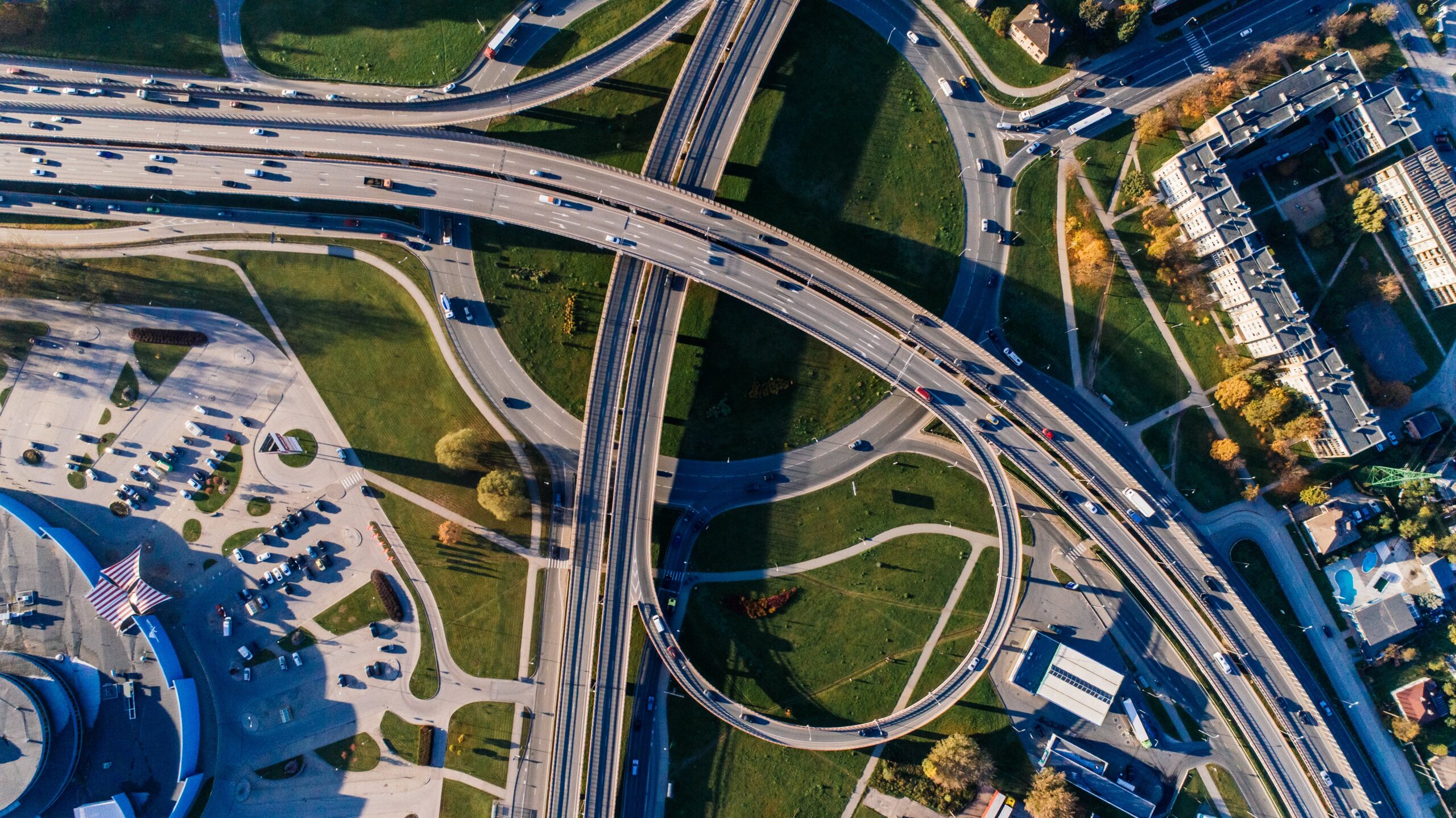
Drones provide unparalleled access to vantage points that were previously impossible or very difficult to reach. They can soar high above landscapes, cities, and structures, capturing breathtaking perspectives that showcase the world from a whole new angle.
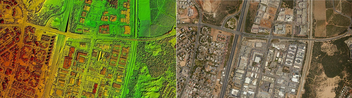
Photogrammetry or aerial photogrammetry, is a powerful technique that combines drone technology with photogrammetry to create detailed 3D models and maps. It involves capturing overlapping images of an object or area from different angles using a drone-mounted camera and then processing those images using specialized software to generate a 3D model.
Drones equiped with multispectral sensors can capture light in multiple wavelengths beyond the visible range, including near-infrared (NIR), red edge, and green edge. This allows them to collect data that can be used to analyze the health and condition of plants, soil, and water.
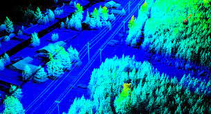
Lidar drones can collect incredibly precise 3D data of terrain, structures, and objects. The laser pulses can penetrate vegetation, making lidar an effective tool for mapping forests and other areas with dense vegetation.
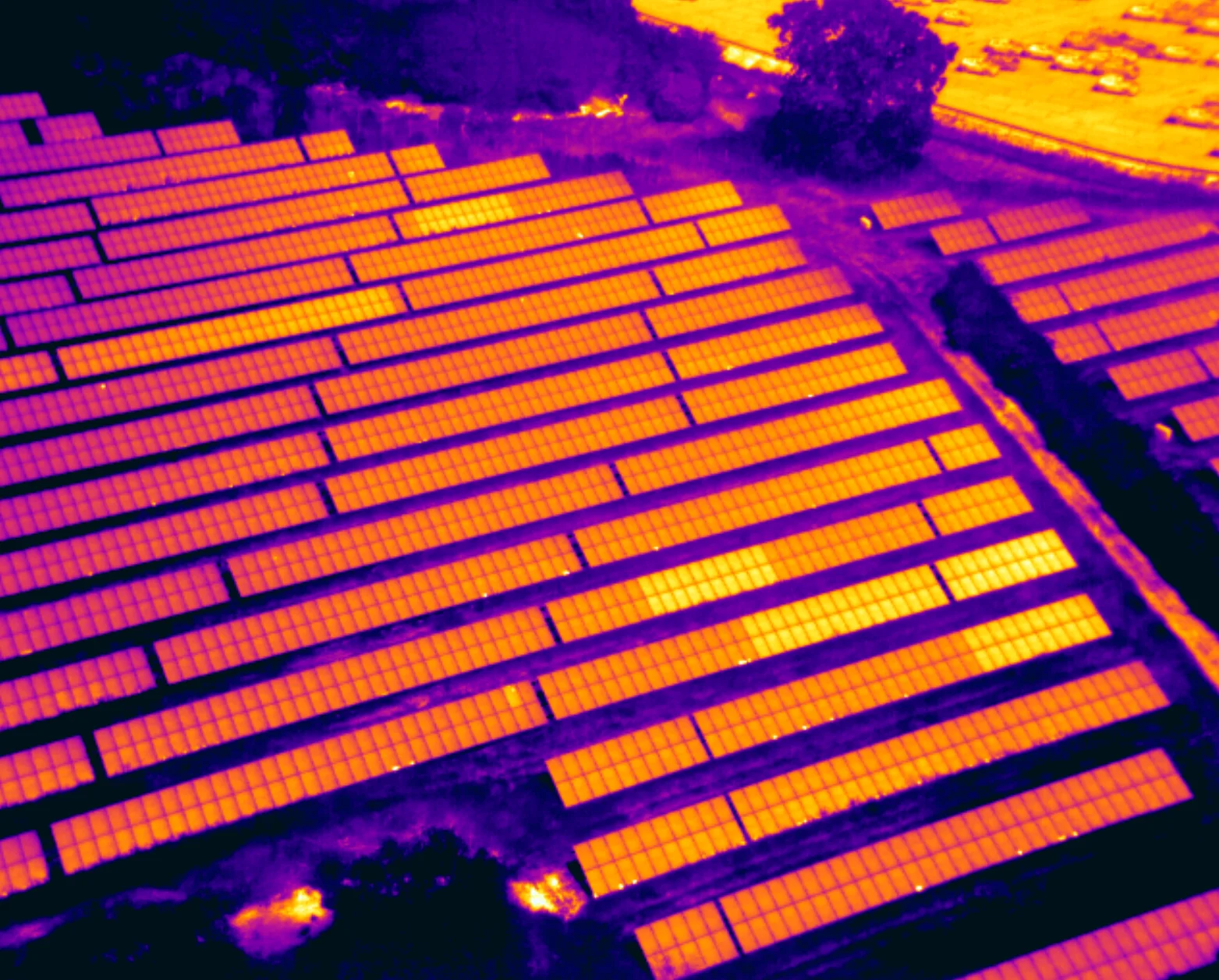
Drone thermal surveys are a type of aerial inspection that uses thermal imaging cameras to collect data on the surface temperature of objects. This data can then be used to identify and assess a variety of issues, such as: Energy efficiency, Structural defects, Moisture intrusion, Electrical faults or Vegetation stress.
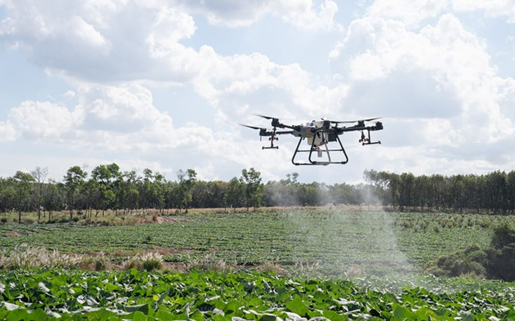
Drones can cover large areas quickly and easily, and they can be programmed to spray in precise patterns, which can help to reduce waste and improve coverage.
Register your account and submit your project today. We will be looking and providing the best solution provider for it.